
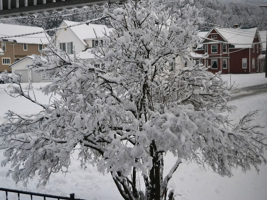


About five inches of heavy, wet snow weighed down the branches on this lilac bush in Hardwick Monday morning. The wet snow also brought down limbs and caused power outages in many areas.
by Tyler Molleur, Community Journalist
HARDWICK – Local children coming back from a Thanksgiving school break had their vacation extended a day as many residents woke up to no electricity and treacherous travel Monday morning. This was the result of an early season winter storm that dumped a variable amount of snow across the landscape.
A winter weather advisory went out ahead of the storm, forecasting a total of two to six inches. The higher terrain outside of the Lamoille and Winooski River Valleys doubled that, all of it wet, heavy, and weighing down tree limbs.
The Hardwick Electric Department reported 3,400 customers out on Monday morning at the peak of the event.
The Washington Electric Cooperative’s (WEC) first update, around 6:45 a.m. on Monday, indicated over 5,000 customers had lost electricity. That number continued to grow through the morning, with more than 6,500 customers out by mid-afternoon. The cooperative estimated that this would be a multi-day outage event for some customers and requested additional support for outside agencies to expedite the progress.
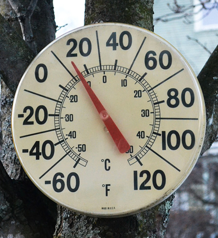
This thermometer on Spring Street in Hardwick read 13 degrees on Saturday, Nov. 25, which was the coldest morning so far this season.
Roughly 3,600 customers remained without power in the WEC coverage area as of Tuesday morning, including about 300 customers across Stannard, Walden, Cabot, Calais, Plainfield, and Marshfield.
Hardwick Electric had 150 customers still out Tuesday morning, and they expected those customers to be back on-line by the end of the day.
Complex elements were at play in the evolution of the weather system that brought heavy snow conditions to northern Vermont. A coastal low developing off of the Delmarva Peninsula Sunday evening strengthened as it moved northward to New York City and southern New England overnight. It phased with another storm system over the Great Lakes and southern Quebec. The southern stream storm funneled copious amounts of moisture in along with some slightly warmer air columns, which competed with colder air attempting to make its way in from the north.
The result was around an inch to an inch and a half of melted precipitation in some of the favored mountain locations, which also had the coldest temperature readings at the time of the event. Some places saw several hours in which the snow fell in excess of one to one and a half inches per hour from midnight to 6 a.m. on Monday, before some areas turned to rain and the precipitation stopped.
North Greensboro reported the highest storm total snowfall Monday morning, with 15.2 inches. Woodbury reported 11.2 inches. Places like Calais, Cabot, and Stannard had close to nine inches, while lower elevations, such as Hardwick village came closer to five inches in snow totals.

