
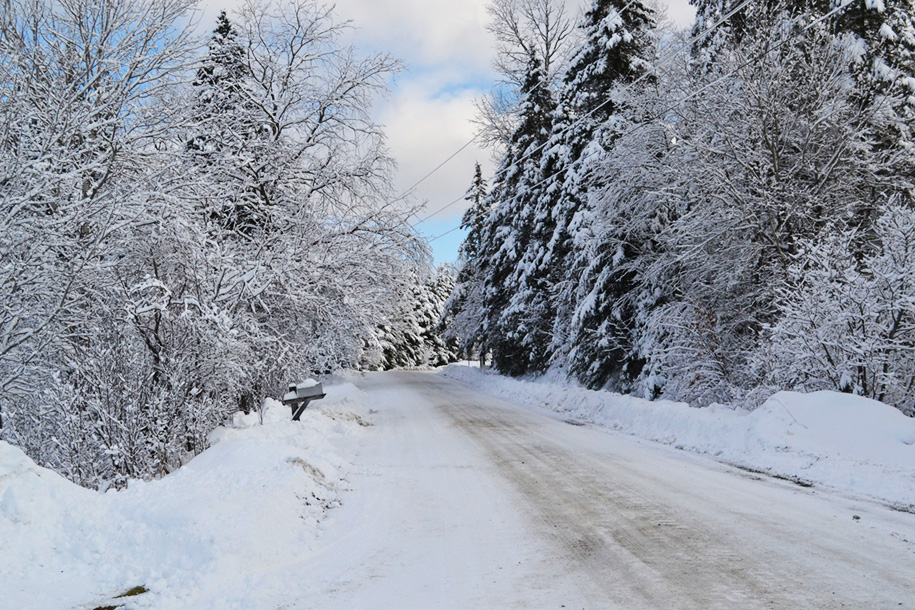


This winter wonderland scene was taken on Cahoon Farm Road in Walden on December 12.
by Tyler Molleur
HARDWICK – One word could be used to describe 2023’s meteorological summary: soggy. This comes after a year of memorable weather events that left our area covered, either in inches of snow or feet of floodwaters. The National Weather Service has observation stations in Plainfield and Morrisville that have been keeping records for approximately a quarter of a century.
As of December 20, the Plainfield co-operative observer station measured 55.61 inches of rain for the year, exceeding the previously set record of 52.71 inches of rain or rain equivalent set in 2011, which was the year of Tropical Storm Irene. In St. Johnsbury, 2023’s 46.4 inches of rain will come up shy of the 2011 record of 51.21 inches.
In the same time frame for 2023, the Morrisville observation station reported 48.1 inches of liquid precipitation. This is just under the previous annual record of 48.44 inches set in 2006. With 11 days remaining in the year, prospects for breaking this record are high.
Several major events during the year contributed to this excessive amount of precipitation. Some highlighted events are outlined below.
December 2023 Flooding
December 18 marked the fourth consecutive Monday with heavy precipitation falling over the region. Contrary to the precipitation that fell in the previous three weeks, the December 18 storm was a primarily rain-driven event, with temperatures reaching the 50s and combining with snow melt to produce flooding along area rivers. This flooding event differed from July’s flash flooding event, as the main concern came from rising larger rivers, while smaller streams had the capacity to absorb the rainfall better in this event.
Over the course of this Monday, the Lamoille River reached major flood stage at established river gauges in Johnson and Jeffersonville, peaking at 17.58 feet at the Johnson gauge overnight Monday night. That crest was among the top five crests in the gauge’s history, which included flooding earlier this year and the 1927 flood.
Rainfall amounts ranged from 1.81 inches in Plainfield and 1.92 inches in Hardwick to 2.62 inches in Walden and 2.88 inches in Wolcott. Flagg Pond Road in Stannard was washed out at approximately 9 a.m. on Monday, with Route 14 south of Hardwick being closed to traffic by early afternoon. US 2 in Plainfield and Marshfield also closed toward sunset as the Winooski River left its banks in the area and multiple roads in Craftsbury closed due to flooding along the Black River.
Overnight on the Lamoille, one water rescue was performed by the Wolcott Fire Department, with two occupants rescued from a stalled vehicle with no injuries. The swollen Lamoille closed down School Street in Wolcott, and as water continued to rise downstream, Route 15 became impassible for several hours until the river crested and receded just after midnight.
Monday Mayhem: Snowstorms
Three rounds of snowfall closed many schools every Monday from November 27 through December 11. Developing coastal lows pulled significant amounts of moist air across the northeast and changed precipitation over to snow as it mixed with a shallow layer of early-season cold air funneling in from the northwest. The track of each individual storm dictated how much precipitation turned to snow and how intense the snowfall was, but the net effect was elevation-dependent accumulation of heavy, wet snow, amounting to close to a foot in some of the hilly terrain, dwindling to a few inches on the valley floors.
Each storm created slippery road conditions and power outages. Of the most significance was the November 27 storm, which put 3,400 Hardwick Electric customers in the dark for several hours, as were over 6,500 Washington Electric customers. Some customers were still waiting for the lights to be turned on the following day, and the Washington Electric Co-operative anticipated that some of their customers would see a multi-day outage event. That storm left as much as 15 inches of snow in Greensboro, 11 inches of snow in Woodbury, and even five inches of snow was recorded in the Hardwick portion of the Lamoille River Valley.
July Severe Weather and Flash Flooding
Hardwick and surrounding towns were in a unique position heading into the flooding that occurred on July 10, which featured copious amounts of steady rain. In the days leading up to the event, multiple rounds of thunderstorms left the ground saturated and isolated reports of flash flooding came in: first in East Hardwick on July 4; followed by roads washed out in Woodbury on July 9. The major event came with torrential downpours that sustained from Monday morning well into Monday night, which resulted in a total of five to eight inches of rain in a 48-hour period.
Many locals and public safety officials could not recall an event that produced such widespread devastation, as Hardwick became an island inaccessible to other towns for the night. Measures to make the state highways passable commenced the following morning, but over a week of stabilizing measures would be needed before this objective would be achieved.
Significant water damage occurred to places like the Woodbury Fire Department, Hardwick Fire Department, and many businesses along Wolcott Street. Volunteers staffed an emergency shelter to assist residents displaced by the flooding. Volunteers were also called upon later that same week as the threat of more severe weather loomed not more than 72 hours after the waters first receded. That severe weather event passed over with little fanfare. Volunteer services were instrumental in facilitating cleanup in the aftermath of the flooding.
After celebrating the opening of the Lamoille Valley Rail Trail, the entire trail in north-central Vermont was forced to close due to multiple washouts, bank erosions, and lost bridges. Work continues this winter to return the trail to its fully operational state, although some sections on either side of Hardwick have re-opened.
Will 2024 be as rain-laden as this year? Only time will tell. Long-term weather outlooks from the Climate Prediction Center forecast a warmer than normal year, with equal chances of below-normal, above-normal, and near-normal precipitation.

