

CABOT —- Bright rainbow colors mark the flood levels in hydraulic mapping of Cabot Village released this past fall. But they show a decidedly gloomy forecast.
With existing infrastructure, a 100-year flood could transform the street into a stream, with water levels reaching about eight feet deep. A 500-year flood could turn the street into a river, 15 feet deep in some places.
Fresh off two summers of historic rainfall, those images aren’t necessary to prove the destructive potential of flooding to Cabotians and others across the state. But for Cabot’s Flood Resiliency Task Force, the maps may be vital in preventing the next catastrophe.
The models, published Oct. 30 by engineers from SLR Consulting, are the product of a months-long study commissioned by the task force. The Waterbury firm was asked to create a model of how water would move across the village and a list of infrastructure changes to mitigate flood risk. The project was funded by a $70,000 federal grant.
The engineers’ recommendations revolve largely around the construction of two new bridges on Main Street across tributaries of the Winooski River. Consultants Roy Schiff and Doug Osborne said current infrastructure, including the bridge before South Walden Road and the culvert under the Cabot Garage, are dramatically undersized.
“They made some convincing arguments that if we replace these structures, we will deal with most of the heavy storm events we’re likely to see at any time in the future,” said task force chairman Gary Gulka.
A November 8 Cabot Select Board vote gave the task force the go-ahead on five of the 10 recommended alternatives. Now Schiff and Osborne are working on concept designs, which Gulka said will be submitted for a Federal Emergency Management Agency (FEMA) grant to get the work done.
Gulka said the alternatives would involve elevating the road on the northern tributary and replacing the existing bridge with one that’s 50 feet long. Additionally, the culverts on the southern tributary would be replaced with a bridge.
Other changes would include removing sediment upstream of both tributaries, widening a snowmobile bridge on the southern tributary and widening the downstream channel on the southern Tributary.
Compared with the 15 other projects he is currently working on across the state, Schiff said the modeling shows substantial benefits with relatively straightforward construction plans.
“Sometimes the modeling results don’t show a lot of benefits without really making changes like having to move a lot of houses or businesses,” Schiff said.
The report had major implications for at least one Cabot business: the Cabot Garage, which sits on a culvert on the southern tributary. One of the alternatives, to replace the culvert with a bridge 30 feet wide and 60 feet across the road, would entail demolishing the building.
Gulka said the task force has already received a buyout grant from the state Vermont Flood Resilient Communities Fund. The grant funds all the necessary steps to get the garage appraised, and it would pay garage owner Greg Moore the appraised value in the case of a buyout.
Gulka said that as of late December, Moore was willing to sign the application for the buyout but can still back out.
“He would be doing the town a big favor by disrupting his business,” said Gulka. “It’s very possible, very likely, that the amount of compensation he would get for that structure would not be adequate to relocate to another site without other funding, loans or support from the town.”
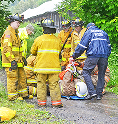
Moore said the garage has been flooded three times in the last 65 years, including last July, which put him out of business for a week. He said he wasn’t considering relocating until the prospect of a buyout was on the table. Although he said he hopes to move somewhere else in town, with limited space in Cabot Village, he is unsure where.
Asked if he sees the buyout as a sacrifice he is happy to make, he said, “If it satisfies both parties, then yes.”
As the January deadline for the FEMA grant approaches, Gulka said he’s not worried about receiving funding or about some of the slow-paced FEMA reimbursements happening across the state.
He said he has faith in the Vermont Emergency Management’s ability to review and prioritize applications around the state before they’re sent to FEMA.
“I would say I’m confident that our projects will rank high in terms of needs and, you know, in the benefits that will result in protecting the village,” he said. “So I’m not worried. I’m just confident.”
In the meantime, the task force is waiting on SLR’s concept designs. And so is Moore.
“I hope that it’s enough,” he said, “and that what the engineering study has come up with will actually fix the issues that we have with flooding in town.”
Lucia McCallum writes for the Community News Service, a University of Vermont journalism internship.

Lucia McCallum writes for the Community News Service, a University of Vermont journalism internship, in partnership with Vermont Public.


For many years, starting when Vermont villages took shape and roads connected them, we lived with “wet crossings.” Those were places where no bridge was in place, but for most seasons animals and wheeled vehicles could go through the water without danger. As a long-time (former) Cabot resident and taxpayer, I need to be convinced that the flood modeling will lead to two bridges in the Village that are practical and affordable. I want people to tell me why we couldn’t create solutions that would channel flowing waters through, around, over and under rebuilt infrastructure. Would it mean that vehicles could not safely pass in some conditions? Of course. And how is that different from what we’ve experienced?
Where I encountered those crossings, they were called ‘fords.’ Having seen how the river bottom of the Lamoille River in and near Hardwick has changed during flood events of the last few years, moving even huge boulders, I wonder how well a crossing like that would hold up.
There was talk of installing one when the Hardwick Farms Road bridge washed out, but other options won out. There are two six foot culverts there now as a temporary measure until a permanent solution is out in place.