

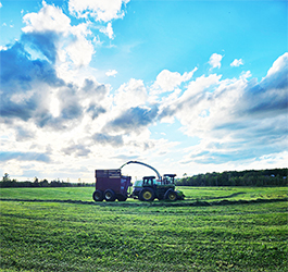


These poppies were in full bloom last week in Hardwick.
HARDWICK – Our extended phase of wall-to-wall sunshine and warming temperatures lasted a little longer than was originally expected and brought with it a six- to seven-day length of absent rainfall. Folks in the garden had to help their plants along with some extra water, as this round of warmth also seemed to lack humidity. The culprit is a strong ridge of high pressure that has settled itself in to the western Atlantic, limiting the progression of frontal systems into the eastern U.S. It is finally going to concede its presence in the next 24 hours, yielding its way to a developing low-pressure system, currently located over the Midwest.
It is worth noting that during the reign of high pressure, Montpelier tied its record high of 84 degrees on Monday, which was last seen in 1949. Other areas, like St. Johnsbury, reached 88 degrees. Morrisville topped out at 86. That pattern will hang on for at least today, before the effects of that approaching front begin to turn everything upside down for the extended period.
With the afternoon heating and rising humidity, the stage is set for some terrain-driven showers and thunderstorms to erupt in a scattered fashion, most likely between 4 and 9 p.m. this evening, with areas closer to the mid-hills and higher terrain seeing some locally heavy rainfall of possibly half an inch to an inch. That activity fizzles out shortly after sunset. The frontal system approaches mid-morning on Thursday and begins to occlude and create an axis of showers and thunderstorms, with a couple of gusty downbursts possible, as it crosses Vermont through the afternoon. It looks like locally heavy rainfall on the order of one to two inches is again possible, but it will be difficult to iron down exactly where that is likely to occur.
The Weather Prediction Center, the national forecasting branch that monitors areas for excessive rainfall, has the area in a marginal risk of flash flooding both Wednesday and Thursday. Any flash flooding will be localized to smaller creeks and streams, which may rise rapidly if repeatedly hit with heavy thunderstorms, but it would not be a region-wide catastrophe like what was seen last July. The riverbeds are very capable of absorbing the runoff from the heavier rains. Still be wary of any road washouts and do not try to drive through them.
The upper low remains over the Great Lakes through the weekend, bringing cooler daytime temperatures and mild overnight temperatures with intermittent cloud cover and showers. The remainder of the weekend will feature periods of showers, but those showers won’t be as intense as the ones when the front passes. Here are the details of the forecast:
Wednesday: Mostly sunny. Scattered showers and thunderstorms developing by evening. Locally heavy rainfall possible. High: 81. Low: 61.
Thursday: Mostly cloudy, with some breaks of sunshine midday. Numerous showers and thunderstorms developing. Some thunderstorms may produce gusty winds and locally heavy rainfall. High: 76. Low: 57.
Friday: Partly cloudy. Scattered showers and isolated thunderstorms. High: 72. Low: 54.
Saturday: Mostly cloudy. Scattered showers. High: 67. Low: 54.
Sunday: Mostly cloudy. Scattered showers. High: 70. Low: 53.

Tyler is our weather reporter and a community journalist. He works as a nurse and EMT, volunteers with Hardwick Rescue and helps to train new EMTs.
