


EAST HARDWICK – The weather pattern shifted significantly over the last week with highs in the 80s dipping into the mid-50s to low-60s by the conclusion of the weekend. This is thanks in part to a low-pressure system that arrived Friday and Saturday, bringing several rounds of heavy rain and thunderstorms to parts of Vermont. Most of that activity was seen during the afternoon hours on Friday and Saturday, with heavier pockets of rain amounting to nearly four inches in parts of western Lamoille and western Washington counties. Flash flooding occurred in this region, along with parts of southern Vermont.
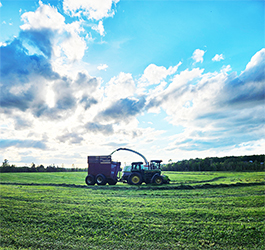
photo by Paul Fixx
We largely avoided that catastrophe with this round of precipitation. However, some areas in our region reported pea- to mothball-sized hail, including Wolcott and Hardwick. Our total rainfall for the week was more on the order of three quarters of an inch to an inch, although some parts of north Greensboro and Plainfield were closer to two inches.
The current weather pattern shows a trough of low pressure lingering over the region from this weekend’s weather event, with mostly cloudy conditions and cooler temperatures remaining. Highs this time of year should be in the lower 70s with lows in the mid-40s. We are continuing to see highs in the mid-50s with lows just slightly below normal.
Brief ridging will occur Wednesday, which will bring some breaks to the clouds and slightly warmer temperatures than we’ve seen in the last 72 hours. This will be short lived as a low-pressure system maturing over the upper Mississippi River Valley begins to lift north and translate its energy into the Great Lakes. A second low pressure system will develop off the mid-Atlantic coast by Thursday evening, with both features advancing slowly north. At the mid-levels of the atmosphere, cold air will get pulled into the northern regions of Vermont and New Hampshire, with areas above 2,000 feet potentially seeing some snow showers Thursday night and again potentially Friday night, with little in the way of accumulation.
Steady rainfall on the order of one inch will continue from Thursday night into the day Saturday for most, with the storm system moving into the Canadian Maritimes by Sunday. A lingering trough will also bring some scattered showers for Sunday although that will be mixed in with periods of clearing. Temperatures will largely remain below normal through the forecast period, although we will slowly inch closer to 60° for a high by the time we get to the end of the weekend. Here are the forecast details:
Wednesday: Partly sunny. High 56. Low 40. Light wind.
Thursday: Mostly cloudy. Scattered showers in the afternoon, then steady rain overnight. Snow showers possibly mixed in at elevations above 2,000 feet. High: 55. Low: 38. Northeast wind 5 to 10 mph, with gusts to 20 mph.
Friday: Rain. Snow showers possible mixed in at elevations above 2,000 feet. High: 54. Low: 39. Northwest wind 5 to 10 mph.
Saturday: Rain. High: 52. Low: 40. Northwest wind 5 to 10 mph.
Sunday: Mostly cloudy. Scattered showers. High: 58. Low: 44. Southwest wind around 5 mph.
…

Tyler is our weather reporter and a community journalist. He works as a nurse and EMT, volunteers with Hardwick Rescue and helps to train new EMTs.
