


EAST HARDWICK — This past week featured several days of steady rain with a couple of sunny days blended in. A total of 0.84 inches of new rain fell at the East Hardwick station, with our total for the month still placing us at about 130%, of normal. This is about half an inch ahead in terms of rainfall. The warmest day of the forecast period was Friday, which had St. Johnsbury reaching 71 degrees and Plainfield topping out at 70. This is in the wake of a 14-degree record low on Wednesday at Montpelier that tied the old record low set in 1982.

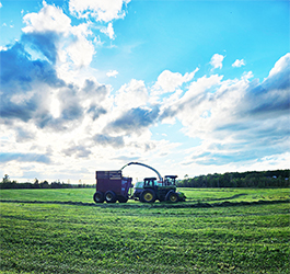
photo by Dawn Gustafson
The start of the work week has already featured steady rain and cloudy conditions as a frontal boundary settled into the St. Lawrence River Valley, where it will set up for the next several days.
Temperatures will be about 10 to 15 degrees above normal for most of the forecast period as we are under the influence of a ridge building over the southeast, which continues to usher warm air into the region. The slow-moving frontal boundary will send waves of low pressure every 24 hours or so. This will continue through Friday. Showers are likely each day, with a few thunderstorms and heavier showers possible, especially on Thursday.
Clouds will linger on Saturday as a stronger and more progressive storm system approaches from the Ohio River Valley. It will become breezy with a southwest wind. Showers are possible overnight on Saturday, with the majority of precipitation from the passage of a cold front occurring midday Sunday. Temperatures behind the front will drop about 25 degrees, with the last of the precipitation Sunday evening wrapping up as a mix changing to snow. Only minor accumulations, if any, are expected. Here are the forecast details:
Wednesday: Mostly cloudy. Showers likely with a chance of thunderstorms. High: 63. Low: 52. Calm wind.
Thursday: Mostly cloudy. Showers, with a chance of thunderstorms in the afternoon. High: 67. Low: 53. South wind 5-10 mph.
Friday: Mostly cloudy. Scattered showers. High: 63. Low: 47. Light and variable wind.
Saturday: Partly cloudy. A chance of showers overnight. High: 67. Low: 48. South wind around 5 mph; becoming 10-15 mph later in the day.
Sunday: Mostly cloudy. Showers likely with a chance of thunderstorms. A chance of snow showers by late afternoon. High: 57, with temperatures falling through the afternoon. Low: 31. Southwest wind 5-10 mph; becoming west.
