


EAST HARDWICK— Conditions started to dry out on Monday following the passage of a frontal boundary Sunday evening that brought widespread showers and thunderstorms. A spot shower or two was noted on Monday, but sunshine was otherwise abundant with highs reaching the mid-60s. Highs should be in the low 70s this time of year, with lows in the mid-40s.

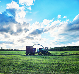
photo by Dawn Gustafson
Sunshine persisted into Tuesday, with highs close to normal. The dry conditions are a far cry from the threat of showers the region has experienced on a nearly daily basis. Not every day was a washout in May, but only three days were reported to be rain-free. 6.26 inches of rain fell during the month, which is 2.43 inches above normal.
An omega block bringing strong ridging to the central parts of the country deflected that precipitation to the western and eastern flanks of the continental U.S. last week. That ridging is shifting east through the rest of the work week, meaning we will have an extended period of about four days without precipitation. Abundant sunshine and a southerly flow will mean temperatures are forecast to rise above normal, nearing record-breaking levels on Thursday with highs in the mid-80s. Dewpoints will continue to be comfortable, so the soupy humidity will be notably absent in the warmth.
The ridging breaks down as we head into the weekend and a warm front slowly sags south from the Canadian border later Friday afternoon. The front becomes stationary as it crosses the northeast over the weekend, with episodes of showers and thunderstorms throughout Saturday, with a lesser chance on Sunday. A band of heavier rain may set up during this time, although there is significant uncertainty with where this system will become stationary, so it is worth paying attention to later forecasts. Here are the forecast details:
Wednesday: Sunny. High: 79. Low: 51. Calm wind.
Thursday: Mostly sunny. High: 84. Low: 54. Calm wind, becoming west around 5 mph.
Friday: Partly sunny. Becoming mostly cloudy with a chance of showers and thunderstorms by evening. High: 79. Low: 56. West wind around 5 mph.
Saturday: Mostly cloudy. Showers likely, with a chance of thunderstorms. Some thunderstorms may contain heavy rainfall. High: 77. Low: 53. West wind 5-10 mph.
Sunday: Mostly cloudy. A chance of showers and thunderstorms. High: 74. Low: 50. Calm wind, becoming east around 5 mph.

Tyler is our weather reporter and a community journalist. He works as a nurse and EMT, volunteers with Hardwick Rescue and helps to train new EMTs.
