
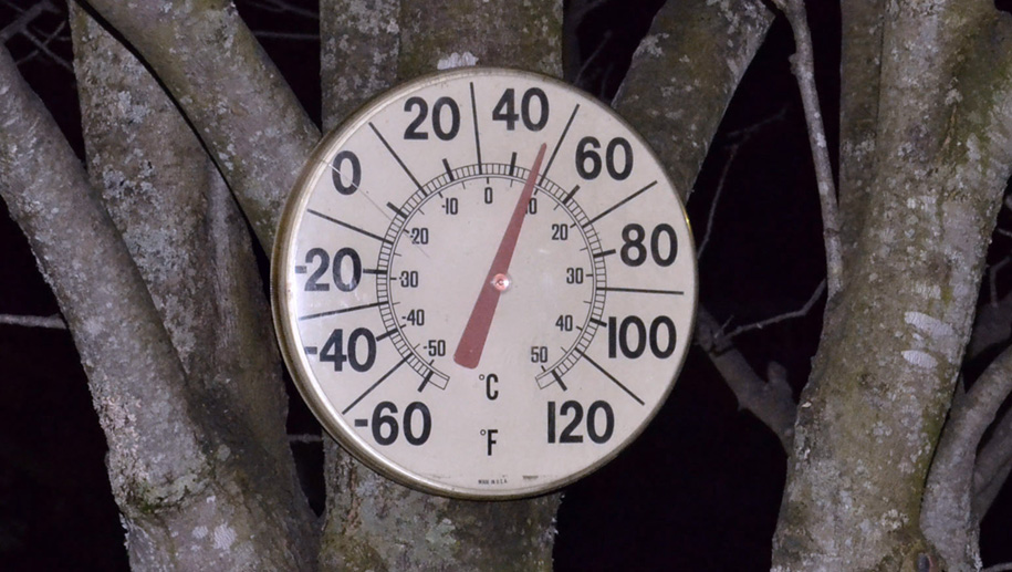


During recent Spring-like weather, a temperature reading of 48 degrees showed on this thermometer in Hardwick on February 28, at 7:48 p.m.
by Tyler Molleur
HARDWICK – Another record-shattering week in the books, as Tuesday of last week easily eliminated old records in several areas. It reached 55 degrees in Montpelier, breaking the former 52-degree record high from 2000. This week the warm air returned, and a record high of 57 was set in St. Johnsbury, surpassing the 55 degree record of 2020. In between these days, we had quite an adventure as rain coming in Wednesday afternoon transitioned to a mix of various frozen precipitation, leading to a crust of sleet and snow from the event. We had a brief period where low temperatures dropped into the single digits before our second moderation occurred during the weekend. It froze in some of the sheltered valleys overnight, but we largely remained above freezing. As a result, it’s challenging to find any consistent snow cover at this time. Elevations above 2,000 to 2,500 feet may have four to six inches, at best.
The southerly winds continue to bring us relatively warm air at the start of the forecast period, with several bits of precipitation directed at us from the Appalachians. The first arrives later today with a burst of rain that amounts to just under an inch of rainfall by the time it departs later tomorrow. A brief transition to snow is also possible. Minimal flooding risk at this time as a result of persistent snowmelt bringing our reserves for runoff down. The departure of this first system does begin to cool things slightly after some breaks of sun lead to another mild day on Friday.
The forecast becomes incredibly challenging for the weekend as temperatures cool and put us in better position for snow, but it remains mild enough that we could be flip-flopping precipitation types overnight Saturday and into Sunday. A wave of rain moves west of us Saturday afternoon with a low chance of some steady rain. A much stronger and organized low develops over the Ohio Valley Saturday night, with low development transitioning to a coastal low off of southern New England Sunday.
Wednesday: Mostly cloudy. Scattered showers, turning to rain overnight. Slight chance of snow by morning, with little to no snow accumulation. High: 54, Low: 32.
Thursday: Rain, tapering off in the afternoon. High: 49. Low: 23.
Friday: Partly cloudy. High: 50. Low: 25.
Saturday: Increasing clouds. Chance of showers in the afternoon. High: 41. Low: 29.
Sunday: Rain, mixing with snow and other precipitation types throughout the day. Precipitation ends as snow overnight, with 2 to 5 inches of accumulation. High: 40. Low: 23.

Tyler is our weather reporter and a community journalist. He works as a nurse and EMT, volunteers with Hardwick Rescue and helps to train new EMTs.


