
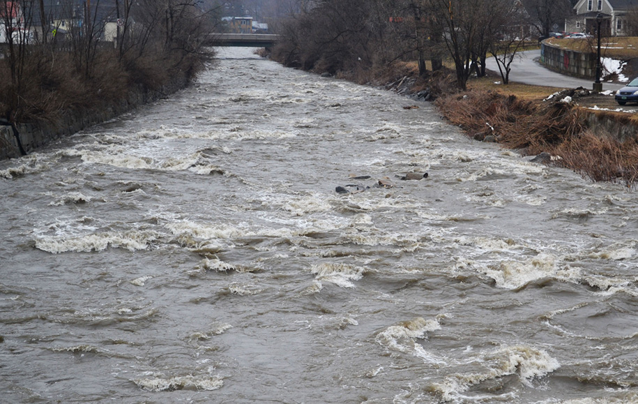


Weather conditions last week of rain and snow-melt contributed to fast-moving higher water levels down the Lamoille River in Hardwick.
HARDWICK – Just as quickly as the snow returned, most of it melted during several days of rainfall over the past forecast period. We saw intermittent spurts of snow Sunday afternoon and evening into Monday night as a couple of weak disturbances passed, leaving an inch or two in their wake. The area received a liquid precipitation equivalent (rain and melted snow together) of about an inch, with seven to eight tenths of an inch falling as rain Thursday and Friday.
Some temperature fluctuations occurred, as highs ranged from the 40s to near 50 through the second half of the work week and began hovering closer to freezing as the weekend progressed. We ended with below normal temperatures that are expected to continue, at least for the short term.
We will have a brief warm-up today ahead of an approaching clipper system which will deliver several rounds of snow showers and reinforcing shots of cold air, bringing our high temperatures down into the low-to-mid 20s for Thursday and Friday. Bursts of moderate to heavy snow are possible from squalls and snow showers enhanced by mountainous terrain, leading to several inches of accumulation in the higher elevations of Cabot, Walden, Greensboro, and Stannard. The rest of us will see closer to three inches of snow between the two days.
We are briefly under the influence of a ridge on Friday, before that erodes and gives way to a northern-stream low moving eastward across the Ohio Valley and a developing low-pressure system to our south. Climatologically, we should expect at least one robust coastal storm this time of year, but typical climatological patterns have been very hit-and-miss lately. Computer modeling gives us no point of clarity as to whether a robust snowstorm is in the cards, and probably won’t for a day or two. We’ve received solutions ranging from a heavy, wet snowstorm to a complete miss. We’re going to describe Saturday as a good chance of snow, with moderate accumulations at this point. Clearing will occur on Sunday although a few snow showers may linger. The forecast:
Wednesday: Mostly cloudy. Scattered rain and snow showers with occasional snow squalls by evening. Total snow accumulations of 2 to 4 inches. High: 35. Low: 18.
Thursday: Mostly cloudy, becoming partly cloudy by evening. Scattered snow showers, mainly in the mid-elevations, tapering off throughout the day. An additional inch of snow possible. High: 22. Low: 10.
Friday: Mostly sunny. High: 25. Low: 18.
Saturday: Cloudy. Periods of snow throughout the day. Total accumulations of 4 to 9 inches. High: 33. Low: 17.
Sunday: Partly cloudy with scattered snow showers. High: 26. Low: 10.

Tyler is our weather reporter and a community journalist. He works as a nurse and EMT, volunteers with Hardwick Rescue and helps to train new EMTs.


