


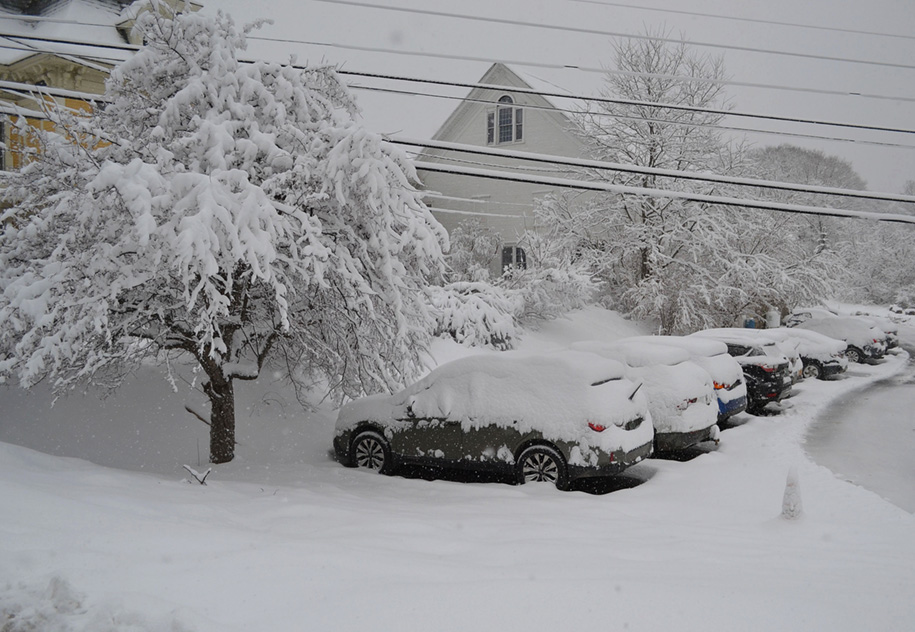
Heavy wet snow covers parked cars in the Jeudevine mansion parking lot on North Main Street in Hardwick last Thursday.
HARDWICK – Even though it was more astronomical than meteorological, Monday’s eclipse quickly became the highlight of the past week, with totality easily visible from our coverage area. The conditions were really what made this event so special, as clearing to the sky in such a manner is a rarity this time of year. At most, a couple of thin high clouds marched in from the south and east, but did little to obscure the sight for viewers.
We were more fortunate to have this much sun compared to many other sites along the totality path from Texas to western New York that were socked in by thicker clouds. Temperatures early reached the mid to upper 50s Monday, with a 10 degree drop shortly after totality.
Not too far in the past, we also experienced a snowstorm. With a tricky forecast track, the storm turned out to be primarily a snowfall event as opposed to mixed precipitation. Places like Greensboro reported 22.5 inches, while Walden had 20 inches. On the lower end, there was 14.5 inches in Wolcott, 13.5 inches in E. Calais, and 12.5 inches in Plainfield. Snow ratios were likely higher in higher elevations where temperatures were slightly cooler. There was enough snow to cause power outages and for trees to block roads.
Little snow is in the forecast for the week, but we will be paying for the sunshine we’ve had. Clouds thicken up today as a front drapes itself over the region. A storm system lifts north from the Ohio Valley shortly after, bringing a warm front into the region and a period of steady light to moderate precipitation starting this evening and continuing through Thursday with strong southwest winds. That rain will become showery and heavier on Friday as a cold front brings a chance of thunderstorms in the afternoon, also causing precipitation to briefly switch to snow Friday night and Saturday morning. Only an inch of snow is expected, at most. A trough means showers will linger through the rest of the weekend with persistently cooler temperatures. Here are the forecast details:
Wednesday: Mostly cloudy. Rain developing by evening. High: 50. Low: 42.
Thursday: Periods of rain. Breezy. High: 53. Low: 45.
Friday: Mostly cloudy. Showers and thunderstorms, especially in the afternoon. High: 58. Low: 32.
Saturday: Mostly cloudy. Scattered rain and snow showers. High: 36. Low: 30.
Sunday: Partly cloudy. Scattered rain showers. High: 44. Low: 35.

Tyler is our weather reporter and a community journalist. He works as a nurse and EMT, volunteers with Hardwick Rescue and helps to train new EMTs.


