
HARDWICK – Somehow the precipitation dodged us for the most part during the last forecast period, with the wettest parts of the region experiencing only up to two tenths of an inch of rainfall in heavier scattered showers on Saturday afternoon. We had more peeks of sun than originally anticipated,[Read More…]
Tyler Molleur
Weather Watch: Seek the Sunshine: Clouds Return Friday
HARDWICK – There wasn’t much in terms of measurable precipitation in the last week, but that didn’t stop the clouds from persisting to create overcast skies for most of the forecast period. We ended up with a combination of rain and snow showers, with the snow amounting to just under[Read More…]
Slightly Warmer Air Will Arrive
HARDWICK – As expected, the past several days have been marked by a warm-up in temperatures that led to mixed precipitation at times on Thursday and Friday, with the primary precipitation type being rain as temperatures warmed to the upper 30s and near 40 during the day. Overnight temperatures barely[Read More…]
Weather Watch
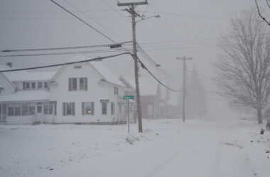
HARDWICK – Seasonally cold air has slowly made its way into the area over the last week, culminating in subzero temperatures and even colder wind chills this past weekend. This also meant the last two higher-profile weather events featured precipitation falling as all snow, a significant departure from what we’ve[Read More…]

Flash Flood Potential Increases Wednesday
HARDWICK – Abnormally wet conditions remain in place for the weather, as we start the forecast period with the likelihood of showers and thunderstorms with the potential to produce very heavy downpours and flash flooding. As mentioned in previous weeks, we have seen 30-day rain totals on the order of[Read More…]

Weather Watch: Flood Threat Continues; Tornado Watch Issued
This afternoon is shaping up to be quite interesting. We are in the middle of a humid and sticky airmass that is being influenced by the remnants of tropical cyclone Beryl, which lies just south and west of Lake Erie at the time of this update. As we move into[Read More…]

Tranquil and Refreshing Week Ahead
HARDWICK – Flood waters receded as quickly on Thursday as they rose on Wednesday night. Not everywhere in Vermont had the same set of conditions priming the risk for flash flooding. As higher-resolution modeling came into more agreement Wednesday afternoon, areas of north-central Vermont already experiencing saturated grounds from above-average[Read More…]


