
HARDWICK – The Granite Street Neighbors project is bringing together historical records, engineering analysis, neighborhood photos and residents’ lived experiences to shape flood solutions. In partnership with neighbors, the Center for an Agricultural Economy (CAE), the Town and SLR International, the effort aims to ensure the Granite Street Historic District is better prepared for future storms.
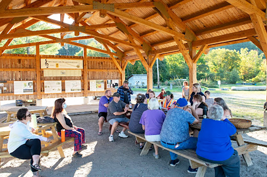
photo by Caleb Kenna, courtesy State of Vermont
Fifteen residents of the Granite Street neighborhood gathered with representatives from SLR International to share their experiences from the 2023 and 2024 floods on September 15. The meeting was a step toward developing a Granite Street Historic District Flood Resilience Plan.
The project is funded through a Municipal Planning Grant (MPG), as a collaboration between the Center for an Agricultural Economy (CAE), the Town of Hardwick and neighborhood residents.
In 2023, the Lamoille County Planning Commission (LCPC) hired SLR International Corporation, an environmental engineering company, to create a model for the Lamoille River and several tributaries, including Cooper Brook in Hardwick. Building on that work, the Town of Hardwick engaged SLR to assist with developing a Flood Resiliency Plan for the Granite Street Historic District.
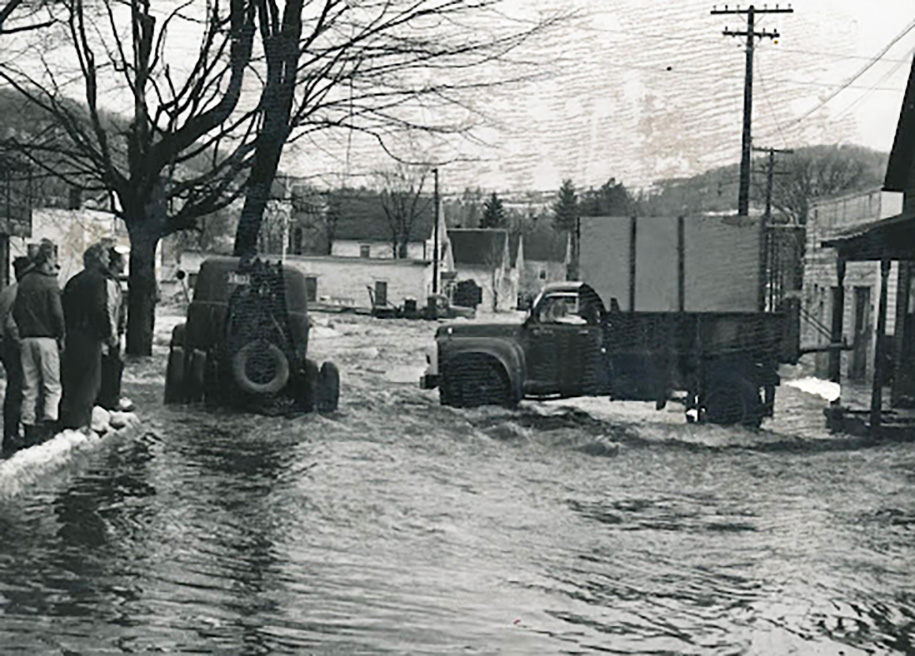
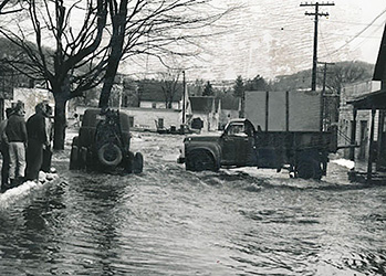
photograph courtesy Hardwick Historical Society
Thirty-two households have completed surveys, and residents at the September 15 provided firsthand accounts of where floodwaters traveled, how high the waters rose and how impacts differed between the Lamoille River and Cooper Brook. Neighbors shared personal photographs of flooding, which provide tangible evidence of water elevations and will be incorporated directly into the plan.
The Granite Street project builds on lessons from previous neighborhood conversations, which helped identify a potential flood mitigation project on the Lamoille River downstream of the Cooper Brook confluence.
On September 25, the Town submitted a Community Development Block Grant Disaster Recovery grant application for a flood storage project in that area to restore 1980s flood benching that has deteriorated in the years since. If funded, the restoration will provide more flood storage for the Lamoille River and Cooper Brook during high water events.
Next spring, the project team will host a workshop series on emergency preparedness topics such as assembling go bags. While designed in response to requests from neighbors participating in the Granite Street Neighbor project, the workshops will be free and open to the wider community.
The neighborhood is working with the town to strengthen communication during emergencies, including exploring a warning system for dam failures, floods and other hazards. The town is actively working to connect residents with funding opportunities to elevate and protect basement utilities, such as furnaces and hot water heaters, that have been damaged in past floods.
Archival research with Elizabeth Dow at the Hardwick Historical Society has uncovered photographs documenting past flood events. Those images reveal two distinct patterns: flooding from the Lamoille River, which has historically affected upstream areas such as Elm Street (notably during a 1964 ice jam), and flooding from Cooper Brook, which tends to push higher waters into the Granite and Cottage Street area.
Several residents commented that the chance to share their experiences helped them feel heard, a reminder that resilience planning is not only about infrastructure and data, but also about building community and recognizing lived experiences.
Kristen Leahy serves as theTown of Hardwick Resilience and Adaptation Coordinator, Katt Tolman serves the Center for an Agricultural Economy as grants manager and Andrea Phelps is a resident of the Granite Street Historic District.


