
HARDWICK – After the floods of 2023 and 2024, the Town of Hardwick heard versions of the same question: what changes after the water goes down?
In the Granite Street Historic District, the answer has not been a single project or a single fix. There has been a slow shift in how the neighborhood, the town, and local partners work together and in how flood risk is understood and addressed.
The Granite Street neighborhood has always been shaped by water. Flooding here is influenced by both Cooper Brook and the Lamoille River, and residents have lived with repeated impacts for years. What has changed since the last two floods is that the work is no longer happening in isolation or only after damage occurs.
Over the past year, residents have begun organizing under the name Granite Street Neighbors, working with the Town of Hardwick and the Center for an Agricultural Economy. It’s a simple thing, a shared identity, but it has made coordination easier and communication clearer. It has also made it possible for residents to be involved earlier, before decisions are finalized rather than after.
Last summer, the Town of Hardwick, with funding from a Municipal Planning Grant, began work on a Granite Street Historic District Flood Resilience Plan with SLR Consulting, in coordination with neighborhood partners. The focus is narrow and practical: understanding conditions on the ground, identifying realistic options and talking honestly about trade-offs. While the plan is specific to Granite Street Historic District, it is expected to inform flood resilience work elsewhere in town.
Some changes are already moving from planning to implementation. A new outdoor early-warning siren for the neighborhood has been funded in the Town’s FY2027 budget and is moving forward. For residents who have experienced fast-rising water, earlier warning is not abstract: it means more time to act.
Other efforts are happening at the watershed scale. Modeling has identified several actions that, together, reduce pressure on the river system during high-water events. These include evaluation of Jackson Dam for potential flood-peak reduction, work with partners to address flood-related constrictions along the Lamoille Valley Rail Trail, newly funded flood bench restoration along the Lamoille River, and the continued transformation of the Sawmill Lane area following multiple buyouts. None of these actions solves flooding on its own, but they work better as a system than as stand-alone projects.
At the household level, Hardwick has secured $700,000 in state funding to help elevate utilities and relocate mechanical systems above flood levels in the most frequently flooded homes. Granite Street Historic District properties in the floodplain overlay will be prioritized, with consistent site assessments guiding how and when work occurs. These improvements do not stop flooding, but they do reduce damage and shorten recovery.
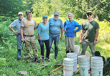
Less visible, but just as important, is the growth of local response capacity. Working with community organizations, including Hardwick Neighbor to Neighbor, the Town has expanded volunteer support, staged an emergency supply and support center, and begun planning a series of winter and spring workshops focused on preparedness and neighborhood connections.
There are also efforts to make flood history visible. A high-water mark installation is planned to document past flood levels and keep risk from fading into the background once cleanup is complete. Coordination is also continuing on upstream high-hazard dams, building on existing modeling and review.
None of this means that the Granite Street neighborhood is fixed. Flooding remains a reality, and future storms will test these systems. What has changed is that the work is more connected, more transparent, and more grounded in the experience of the people who live there.
That shift matters, not just for the Granite Street Historic District, but for how Hardwick approaches resilience as a whole community.
Kristen Leahy is the Town of Hardwick zoning and floodplain administrator.


