


GREENSBORO – Caspian Lake’s historically low water levels have been the subject of much conversation in a town that depends on the lake to draw summer visitors.
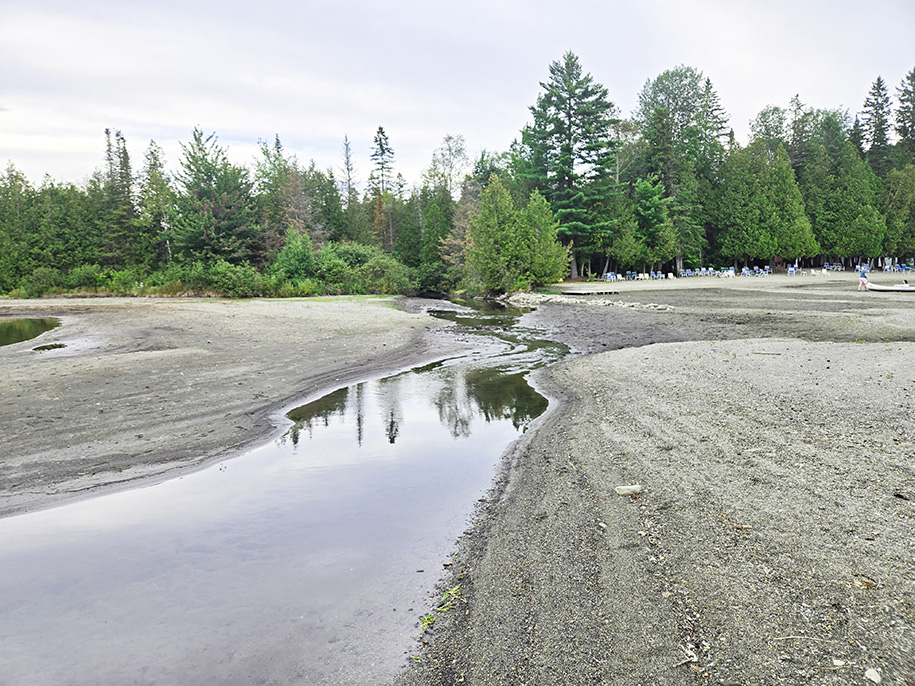
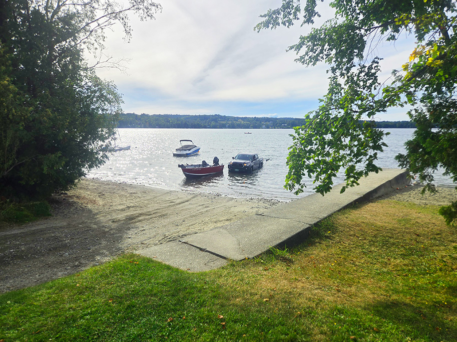
With the lake more than 12 inches below its eight-year average on September 1, and 18 inches below its spring level this year, swimmers at the lake’s beach and those using the Hardwick Electric Departments (HEDs) ramp to launch and retrieve boats have had to contend with a longer distance into deep water, and rocks that are usually well submerged.
For some young swimmers, the low water level has created new adventures as they’ve been more easily able to explore the swim area’s informally-named boulders: “Big Yellow,” “Little Yellow” and “Fisherman’s.” Many new boulders well outside the swim area are now close enough to the surface that adventurous swimmers can locate and stand on them.
The low water level has prevented the launching and retrieving of some large watercraft, and all boaters have had to back well off the end of the ramp, where they’ve had to contend with, and sometimes move, large stones.
At the August Greensboro Association meeting, Stew Arnold reported on lake conditions and John Clark raised the issue of how the low lake level affects recreation and whether the dam might be adjusted to raise the level.
Two weeks ago, Hardwick Town Manager David “Opie” Upson said the state was recently asked to close the weir at the Caspian Lake dam, but denied the request.
The lake level is down well over 18 inches from its spring level and roughly 40 inches from its level July 10 to 12, 2023, when a sheet of water was flowing over the wall south of the dam’s spillway.
High water at Caspian Lake isn’t unusual as a report by John Schweizer in June 2019 noted, “Shoreline flooding and ice damage, particularly along the north and west shores of the Caspian Lake occurred again this winter. The damage was due mostly to the highest water levels in the past 20 years. On April 22, the water measured 29 inches above the spillway and breached the top of the concrete dam.”
Schweitzer’s measurement, September 1, showed the lake level now 11 inches below the spillway, 40 inches below its high level in 2019 and 2023.
The Greensboro Association (GA) was formed over 90 years ago with a goal of protecting Caspian Lake. Schweitzer is among a group of its volunteer Watershed Stewards who “. . . take a stewardship role in monitoring the lake level and making emergency requests regarding the lake level, acting as liaisons with the state (who controls the level), and HED (who owns the dam), as well as with other local entities and state agencies,” they wrote in a recent message with FAQs “intended to help clarify how the lake level is currently managed.
“Over the past 10 years, the GA has requested greater control of Caspian’s lake level management on the basis that the shoreline is stressed by human impact, the dam is stressed (currently rated poor in reports), and the extreme highs and recent lows of the lake level may be adversely affecting the health of the lake. This conversation is ongoing regarding lake level management practices with the state and dam repairs with HED.”
The Vermont Department of Environmental Conservation (DEC) within the Agency of Natural Resources (ANR), which has jurisdiction over the waters of all the state’s inland lakes, is responsible for managing levels for each body of water, said the GA FAQs. The DEC no longer allows utilities to manage lake levels through storage and dispersal for hydroelectric production and now controls the adjustment of the utility dams.
The Caspian Lake dam was built in 1926. From 1926 through the late 1940s the lake was subject to dramatic drawdowns each fall. Since then, the lake has more or less maintained its present levels.
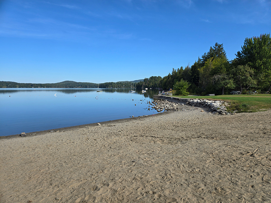
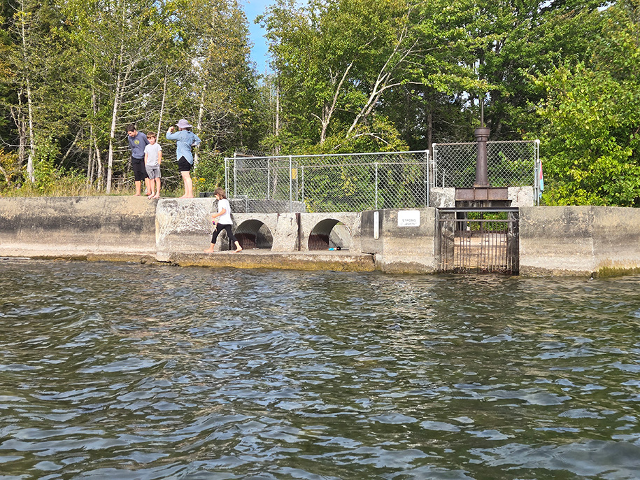
photo by Paul Fixx
The Caspian Lake dam has a weir gate that can influence the lake levels. HED has the key to the weir to adjust flow through the dam, but is not permitted to adjust the weir gate without DEC’s approval and the DEC has instructed all utilities to leave lake levels to a run of nature.
The weir gate has allowed 11 inches of water to flow beneath it since it was set there just before the July 10, 2024 storm with approval of DEC Dam Engineer Ben Green. With the weir set at the 11 inch opening, “the lake level increased to just shy of breaching the southern dam wall before receding. The lake level remained above averages until late June of 2025,” said the FAQs.
Requests were made by the watershed stewards, first in early August, and again August 28, to adjust the weir setting to slow the decreasing lake level resulting from the drought conditions, forecasted to continue beyond 30 days, and because the current lake level is below the footings of the dam, therefore causing minimal stress on the structure.
The DEC’s Green denied both requests, explaining in response to the second, “Low flows and levels are being observed at lakes, reservoirs and streams throughout Vermont. At this time, further reducing flows to downstream receiving waters is not being allowed and adjusting gates more closed to more open later on violates water quality requirements and given the dam safety considerations here, is not preferred.”
photo by Dawn Gustafson
The watershed stewards said they, “have worked diligently for many years to document and advocate for greater local control of Caspian’s lake levels, but devastating back-to-back flooding events have delayed progress. The DEC is continuing to listen to the GA requests for greater control and has planned a program review to establish such a process.
“As Vermont’s drought conditions continue, the GA’s Watershed Stewards will continue to closely monitor Caspian Lake and its interconnected ecosystems.”
With the lake water level low, deep vertical cracks can be seen in the concrete structure
next to the weir and a wall to the north of the spillway is falling into the lake. In evaluating the risk of raising the water level, the state must take into account the roughly 850 million gallons of water held back by the dam between its current level and its April 22, 2019, level, 40 inches higher.
Historical reports of the lake level prior to construction of the dam were five inches lower than they are now, said Schweitzer.
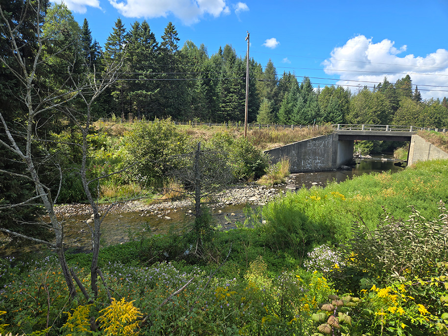
photo by Paul Fixx
After leaving Caspian Lake, Greensboro Brook enters the Lamoille River in Greensboro Bend, just after it passes under Vt. Route 15. It then flows through Hardwick and other downstream towns until it reaches the first downstream measurement gauge in Johnson. The river level there was just under two feet Monday, 26 percent of normal and down 6 percent in the past day, according to USGS data. The river there was at 17.82 feet on July 11, 2024, and two feet higher, at 21.01 feet on the same date in 2024. Both are well below the 27 feet estimated there almost 100 years ago, on November 4, 1927.
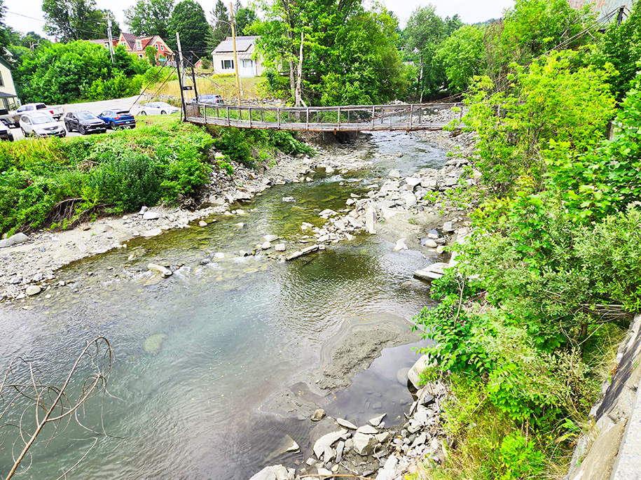
photo by Paul Fixx
The Lamoille River’s final destination, in Lake Champlain, was at 93.41 feet Monday. about a foot below its average for that date of 94.4 feet. That’s similar to the level of Caspian Lake now, a foot below its recent historical average.
Lake Champlain’s minimum for that date was 92.76 feet, in 1934, not much above the 92.09 foot level, its lowest ever, on January 4, 1908.
“With rocks and debris sticking out from the water, propellers are being damaged, and docking has become more challenging,” reported WPTZ last week, before the holiday weekend, At that level state park attendants and marina owners have been warning boaters there to operate with greater caution, said the report.
Editor’s note: An earlier version of this story spelled John Schweizer’s name incorrectly.

Paul Fixx is editor of The Hardwick Gazette and lives in Hardwick.


