
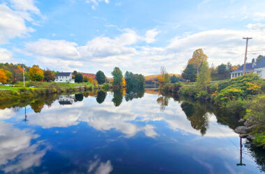
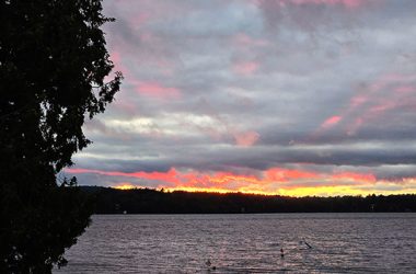
EAST HARDWICK – A surge of warm weather brought us out of the seasonable conditions we have experienced as of late, with both Sunday and Monday high temperatures remarkable for reaching the upper-70s to mid-80s. Montpelier’s new record of 84 degrees on Sunday surpassed its old record of 82 set[Read More…]
Weather Watch

No rain next seven days; warmer than normal weekend
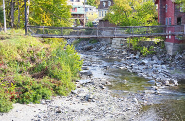
EAST HARDWICK – The most substantial rain of the season fell in the past week, with a total of 1.25” recorded at this observation station. This was the lowest total when compared to nearby stations in Greensboro and Craftsbury, where amounts totaled closer to two inches. Most stations are still[Read More…]
Some rain in the forecast; weekend looks mostly dry
EAST HARDWICK – Temperatures plummeted Friday night and Saturday night under strong radiational cooling, with low temperatures at this station reaching 28 degrees Saturday morning and 25 degrees Sunday morning. Effectively, this was a killing freeze in this local hollow. Hardwick came in with 32 degrees and Craftsbury Common reported[Read More…]

No Substantial Precipitation In Sight; Progressing From Mild To Cool
EAST HARDWICK – Remember the days of noting how often it rained during the weekends as the weather warmed up and spring was underway? Rarely are we complaining that is the case now, but we still see a shower every now and then on a weekend day. That was the[Read More…]
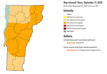
Vermont officials ask residents to report drought impacts
VERMONT – As drought conditions worsen in Vermont, state officials are asking residents to report the impacts. On Thursday, the Agency of Natural Resources encouraged Vermonters to communicate information on dry wells and water supplies, farm losses, crop damage, low water levels in rivers, lakes and recreational areas, and other[Read More…]
Cool, dry conditions persist for another week
EAST HARDWICK – Some rain appeared in our neck of the woods over the weekend, thanks to an upper-level disturbance that brought a round of showers and thunderstorms midday Saturday and followed through with some sporadic showers on Sunday afternoon. Total rainfall in East Hardwick amounted to 1.11”, with nearby[Read More…]

Periods of showers in the forecast; turning colder
EAST HARDWICK – Conditions are partly sunny looking outside this Tuesday morning, following a Labor Day that featured some clouds from an approaching disturbance to our south. Overnights have been cool with low temperatures falling into the 40s, and highs reaching up to 80 degrees on Labor Day, following several days[Read More…]

Much cooler by late week; few showers as well
EAST HARDWICK – Another week of August, another week we’re struggling to play catch-up with some desperately needed precipitation. Total rainfall amounts from August 18 through August 25 ranged from one tenth to one half of an inch. This leaves us still two inches of rainfall short for the month.[Read More…]
Some precipitation to begin, end forecast
EAST HARDWICK – After another brief period of warmth during the middle of last week, the onion is starting to peel a bit to give us a preview of the fall-like conditions that will be more consistent in our future. The first frontal passage on Thursday led to a drop[Read More…]
Small Amounts of Rain and Cooler Conditions
EAST HARDWICK – A stretch of fair weather with moderating temperatures was the primary theme for the previous forecast period. Little in the way of rainfall accumulated across a large portion of our forecast area in the Lamoille and Winooski River headwaters. Less than a tenth of an inch of[Read More…]
Seasonable, Mostly Unchanged, Warming Into Weekend
HARDWICK – While Tyler takes the week off, the big news of the last several days is almost perfect Vermont summer weather, with relatively moderate daytime temperatures in the 70s to low 80s and nighttime temperatures getting into the 50s, though one night last week touched the 40s in some[Read More…]
Fall-Like Forecast Period; Some Warming By Sunday
EAST HARDWICK — The calendar is showing July, but the upcoming forecast period will quickly transition to conditions that feel like mid-September. This comes in the wake of a week where temperatures were all over the place, with some highs approaching 90 degrees and a comfortable night where lows dipped[Read More…]


